Complete ecotouristic information database on national parks of Vietnam.
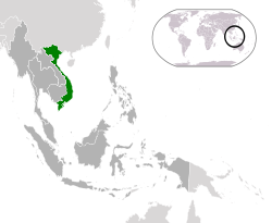
Vietnam is the easternmost country on the Indochina Peninsula in Southeast Asia. With an estimated  90.3 million inhabitants as of 2012, it is the world's 13th-most-populous country, and the eighth-most-populous Asian country. The country is bordered by China to the north, Laos to the northwest, Cambodia to the southwest, and the South China Sea to the east.
It covers a total area of approximately 331,210 km2, making it almost the size of Germany. The combined length of the country's land boundaries is 4,639 km, and its coastline is 3,444 km long. At its narrowest point in the central Quảng Bình Province, the country is as little as 50 kilometres across, though it widens to around 600 kilometres in the north. Vietnam's land is mostly hilly and densely forested, with level land covering no more than 20%. Mountains account for 40% of the country's land area, and tropical forests cover around 42%.
The northern part of the country consists mostly of highlands and the Red River Delta. Phan Xi Păng, located in Lào Cai Province, is the highest mountain in Vietnam, standing 3,143 m high. Southern Vietnam is divided into coastal lowlands, the mountains of the Annamite Range, and extensive forests. Comprising five relatively flat plateaus of basalt soil, the highlands account for 16% of the country's arable land and 22% of its total forested land. The soil in much of southern Vietnam is relatively poor in nutrients.
The Red River Delta, a flat, roughly triangular region covering 15,000 km2, is smaller but more intensely developed and more densely populated than the Mekong River Delta. Once an inlet of the Gulf of Tonkin, it has been filled in over the millennia by riverine alluvial deposits. The delta, covering about 40,000 km2, is a low-level plain no more than 3 meters above sea level at any point. It is criss-crossed by a maze of rivers and canals, which carry so much sediment that the delta advances 60 to 80 meters into the sea every year.
Because of differences in latitude and the marked variety in topographical relief, the climate tends to vary considerably from place to place. During the winter or dry season, extending roughly from November to April, the monsoon winds usually blow from the northeast along the Chinese coast and across the Gulf of Tonkin, picking up considerable moisture. Consequently, the winter season in most parts of the country is dry only by comparison with the rainy or summer season. The average annual temperature is generally higher in the plains than in the mountains, and higher in the south than in the north.
Vietnam has two World Natural Heritage Sites – Hạ Long Bay and Phong Nha-Kẻ Bàng National Park – and six biosphere reserves. Vietnam lies in the Indomalaya ecozone. Vietnam is one of twenty-five countries considered to possess a uniquely high level of biodiversity. It is ranked 16th worldwide in biological diversity, being home to approximately 16% of the world's species.
Detailed information on Vietnam National Parks.
There is a database of this country national parks available. If you have any question or request you can send it by attached Informative Form.