Complete ecotouristic information database on national parks of Madagascar.
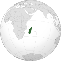
Madagascar, is an island country in the Indian Ocean, off the coast of Southeast Africa. The country  comprises the island of Madagascar (the fourth-largest island in the world), as well as numerous smaller peripheral islands. Following the prehistoric breakup of the supercontinent Gondwana, Madagascar split from India around 88 million years ago, allowing native plants and animals to evolve in relative isolation. Consequently, Madagascar is a biodiversity hotspot; over 90 percent of its wildlife is found nowhere else on Earth. The island's diverse ecosystems and unique wildlife are threatened by the encroachment of the rapidly growing human population.
At 592,800 square kilometres, Madagascar is the world's 47th largest country. Neighboring islands include the French territory of Réunion and the country of Mauritius to the east, as well as the state of Comoros and the French territory of Mayotte to the north west. The nearest mainland state is Mozambique, located to the west.
Along the length of the eastern coast runs a narrow and steep escarpment containing much of the island's remaining tropical lowland forest. To the west of this ridge lies a plateau in the center of the island ranging in altitude from 750 to 1,500 m above sea level. These central highlands, are the most densely populated part of the island and are characterized by terraced, rice-growing valleys lying between grassy hills and patches of the subhumid forests that formerly covered the highland region. To the west of the highlands, the increasingly arid terrain gradually slopes down to the Mozambique Channel and mangrove swamps along the coast.
Madagascar's highest peaks rise from three prominent highland massifs: Maromokotro 2,876 m on the Tsaratanana Massif is the island's highest point, followed by Boby Peak 2,658 m on the Andringitra Massif and Tsiafajavona 2,643 m on the Ankaratra Massif. The western and southern sides, which lie in the rain shadow of the central highlands, are home to dry deciduous forests, spiny forests, and deserts and xeric shrublands. Due to their lower population densities, Madagascar's dry deciduous forests have been better preserved than the eastern rain forests or the original woodlands of the central plateau. The western coast features many protected harbors, but silting is a major problem caused by sediment from the high levels of inland erosion carried by rivers crossing the broad western plains.
The combination of southeastern trade winds and northwestern monsoons produces a hot rainy season (November–April) with frequently destructive cyclones, and a relatively cooler dry season (May–October). Rain clouds originating over the Indian Ocean discharge much of their moisture over the island's eastern coast; the heavy precipitation supports the area's rain forest ecosystem. The central highlands are both drier and cooler while the west is drier still, and a semi-arid climate prevails in the southwest and southern interior of the island.
As a result of the island's long isolation from neighboring continents, Madagascar is home to an abundance of plants and animals found nowhere else on Earth. Approximately 90 percent of all plant and animal species found in Madagascar are endemic, including the lemurs, the carnivorous fossa and many birds. This distinctive ecology has led some ecologists to refer to Madagascar as the "eighth continent".
Detailed information on Madagascar National Parks.
There is a database of this country national parks available. If you have any question or request you can send it by attached Informative Form.