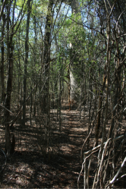
Basic ecotouristic information on Kirindy Mitea National Park (Madagascar) - localization, access, characteristic, fauna and flora, possible activities.
Localization
West Madagascar, 70 kilometres south of Morondava.
Access
Quite difficult - 4x4 vehicle only. More than 70km from the nearest paved road.
Characteristic
722 km2; Lowland flat area on the south-west coast of the Mozambique Channel between Maharivo River and Lampaolo River (altitude up to 180 m). This park protects the unique wildlife of the hot and dry transitional landscape between southern spiny forest, western dry forest, and coastal mangroves. Species endemism is very high. The weather is always hot with over 30 degrees Celsius. Annual amount of rainfall 575-1330 mm. Typical ecosystems: dry deciduous forest, tropical dry forest, spiny forest and sand dunes.
Fauna + Flora
Species List - See the Attachment Below
(Species list may not be complete)
Possible activities
There are three hiking circuits through the park - easy walking three to five hours.
Pirogue trip along the coast and the mangroves.
Note
Best time to visit V-XI.
Rarely visited park by tourists.
Biosphere reserve of UNESCO.
Contact us
Would you like to have any information on above mentioned national park or would you like to join us to travel there? Please, fill up the attached form.