Basic ecotouristic information on Tsingy de Bemaraha National Park (Madagascar) - localization, access, characteristic, fauna and flora, possible activities.
Localization
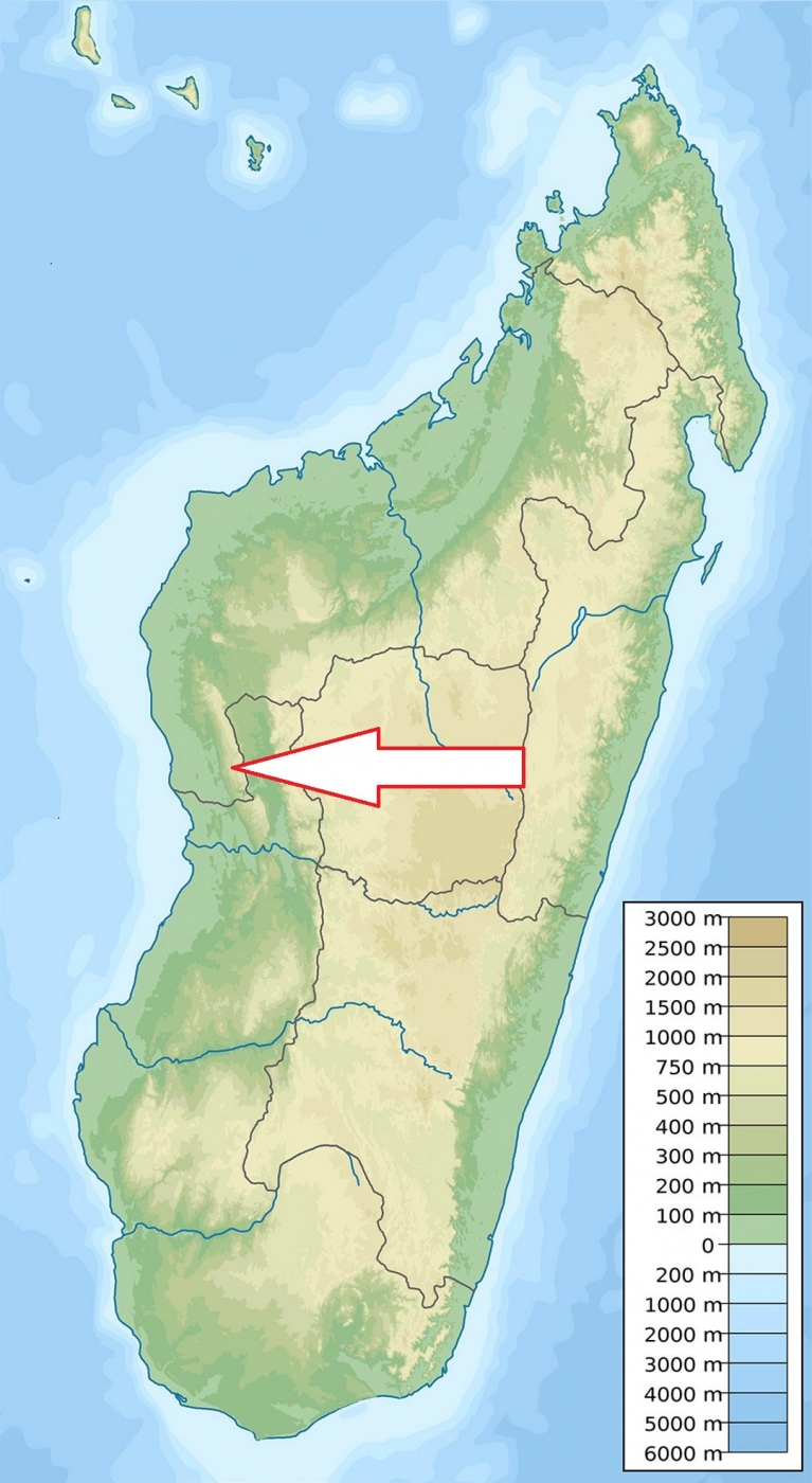
West Madagascar about 250 north of Morondava
Access
Quite difficult. Off-road vehicle from Morondava is recommended to reach the park. The route is basically open from the beginning of May to November, i.e. during the dry season.
Characteristic
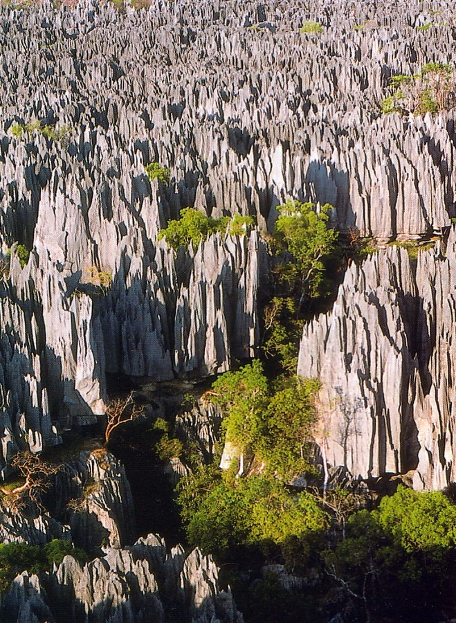
723 km2, Karstic plateau in which groundwater has undercut the elevated uplands, and has gouged caverns and fissures into the limestone. Because of local conditions, the water and wind erosion is patterned vertically as well as horizontally forming limestone pinnacles rising up to 100 metres. The western part of the plateau presents a very dissected or ‘lapiezée’ relief, most of which is covered by a dense, dry and deciduous forest. In its eastern part, the forest is interspersed by savannas. Dry and hot climate. The average day temperature on the karst plateau used to be about 35oC, even higher. Only deep among Tsingys , there are humid climatic conditions, so that sometimes even small lakes and mangrove forests can be found in the gorges. Two large rivers cross the park: the Tsiribihina and the Manambolo. Typical ecosystems: rain forest, dry forest, savanna, karst biotopes, mangroves, freshwater ecosystems.
Fauna + Flora
Species List - See the Attachment Below
(Species list may not be complete)
Possible activities
There are several hiking trails. Some of them are quite difficult including via ferrata with rope protection hiking. During hiking suspension bridges and narrow caves have to be got over.
Caving tours, pirogue trip.
Note
One of the most spectacular landscapes of Madagascar
Park is listed as UNESCO World Heritage Site.
Best time to visit V-XI, in the rainy season it is not possible to get through.
Contact us
Would you like to have any information on above mentioned national park or would you like to join us to travel there? Please, fill up the attached form.