Basic ecotouristic information on Manusela National Park (Seram, Indonesia) which can be visited - localization, access, characteristic, fauna and flora, possible activities.
Localization
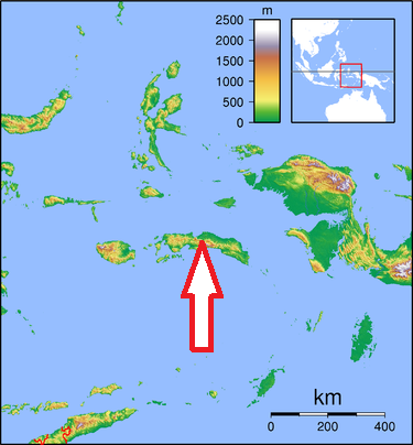
Across the central part of Seram Island (Maluku)
Access
Quite difficult. The Park can be reached either by the north coast (Sawai and Wahai), or the south coast (Tehoru and Moso).
From Ambon to Tehoru by motor boat (about 9 hours), then to Moso and Saunulu village.The route from Moso is preferred by those like climbing, since it has a slope of about 30%.
From Ambon to Saka by bus and ferry (daily), about 8 hours, then proceed to Wahai by speedboat, about 2 hours. Alternatively, from Ambon to Wahai by ship, about 24 hours (3 times a week). There is a flight from Ambon to Wahai once a week.
Characteristic
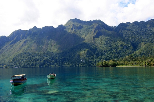
1,890 km2; The park includes sections of two major east-west mountain ridges, deep-grilled river valleys. North of the mountain chain are smaller hills and alluvial plains with low ridges of coral limestone and coral sands. Park altitude - from the sea level to 3,027 m. Mount Binaiya at 3,027 meters, is the highest of the park's six mountains. Estuarine habitats at the river mouths and at the north-west extremity of the reserve are steep limestone cliffs of approximately 100 m height. Typical ecosystems: coastal forest, swamp forest, lowland rainforest, cloud forest, sea and sea coast, mangroves, freshwater ecosystems, wetlands, subalpine ecosystems.
Fauna + Flora
Species List - See the Attachment
Possible activities
Many trekking trails - 70 km long trail enables to cross the park from the north to the south.
Mountain trekking - climbing Mt. Binayia summit.
Caving.
Note
Best time to visit: V-X
A major threat is posed by illegal deforestation, another threat is posed by illegal wild bird trading.
There are no losmen or hotels in the park. You can sleep and eat in the villages but accommodation and food are simple.