Basic ecotouristic information on Yacurí National Park (Ecuador) - localization, access, characteristic, fauna and flora, possible activities.
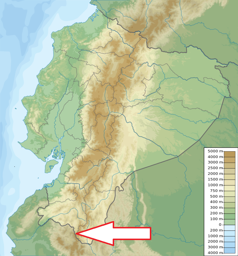 Localization
Southernmost part of Ecuador on the border with Peru, southeast of the town of Amaluza.
Access
Quite easy - From the city of Loja - take the road to Amaluza (120 km paved and 30 km unsealed). From this town you can access various sites in the park.
Characteristic
431km2; Mountainous area of Southern Andes characterized by very steep slopes and deep valleys. 46 glacial high altitude lakes - Laguna Negra is an extremely deep lake in the caldera of an extinguished volcano. Geological formations are varied, dating from different geological periods. Altitudinal range: 2800 - 3600 meters. Typical ecosystems: dry mountain shrubland, upper mountain evergreen forest, cloud forest, mountain steppe (páramo), moorlands, wetlands, freshwater ecosystems.
Fauna + Flora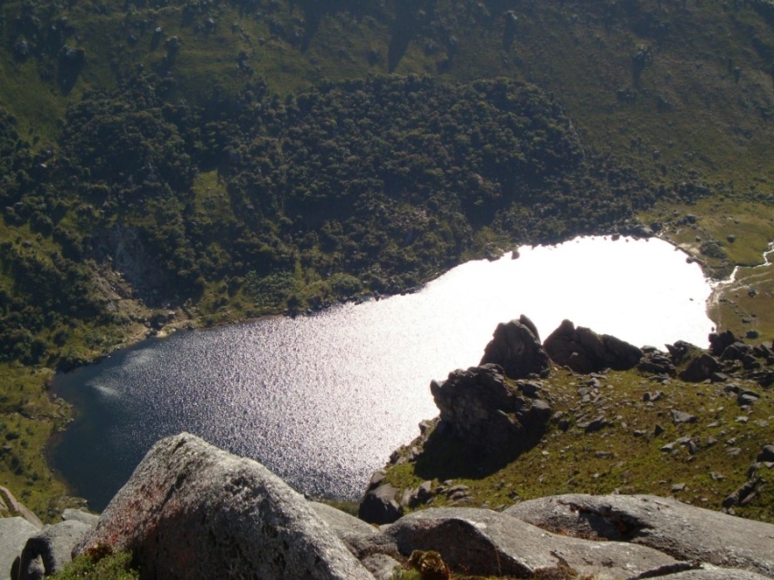
Species List - See the Attachment Below
(Species list may not be complete)
Possible activities
Trekking -lots of trails, the Inca Trail passes through the park .
Mountain bikes, horse riding.
Note
Archeological ruins including petroglyphs inside the park.
Laguna Negra is known for its medicinal mineral water.
Yacuri is a part of the Podocarpus - El Condor Biosphere Reserve of UNESCO.