Basic ecotouristic information on Sumaco Napo - Galeras National Park (Ecuador) - localization, access, characteristic, fauna and flora, possible activities.
Localization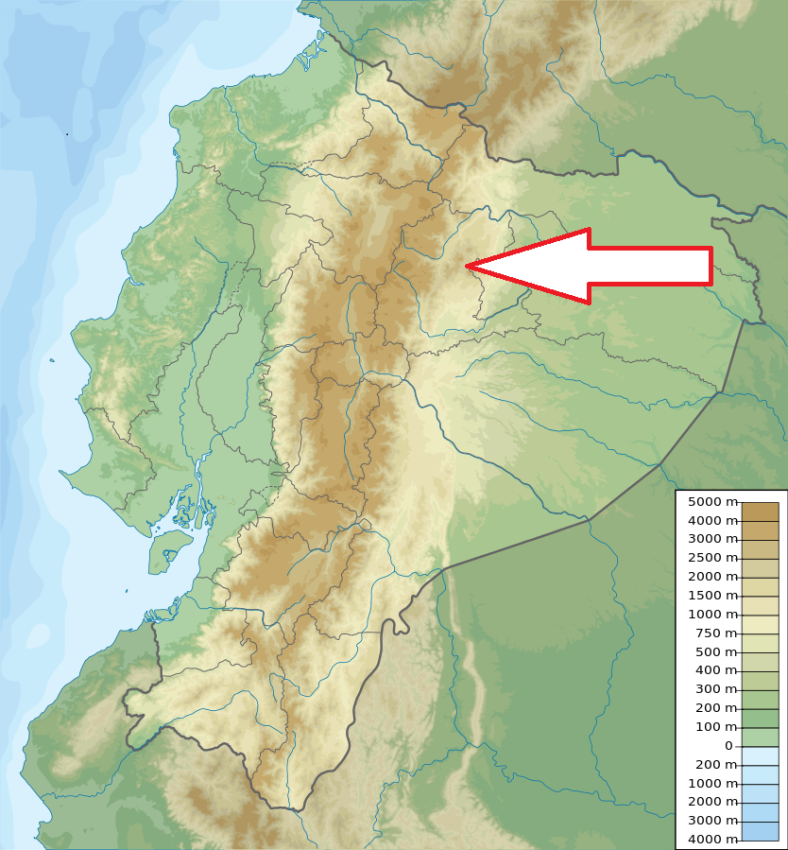
Northeast Ecuador, 100 km southeast of Quito and 35 km northwest of Loreto.
Access
Difficult, Travelling from Quito: take the Papallacta-Baeza-Tena road. At km 24, Narupa area, continue on the route Hollin-Loreto until you reach an area named Wawa Sumaco. From here continue until you reach the Pacto Sumaco community where you´ll find the entrance to the park.
Characteristic
2 052 km2; The park is comprised of two sections. The biggest section has an area of 1 940 km2 and includes the Sumaco volcano (3,732 meters high), the Pan de Azucar hill (3,482 meters high), and the Negro hill (3,127 meters high). The smaller section covers an area of 112 km2, and is located south of the Sumaco volcano belonging to the Napo-Galeras mountain range, whose highest point is at 1,730 meters. Sumaco volcano has almost perfect conic shape and still is not very widely known due to the fact that it is located on an inhospitable area. Its crater has a diameter of 270 meters.There is not much information regarding its eruptions. The area is relatively isolated from the rest of the snowcapped mountains. These are the slopes and hills that surround Sumaco, the only volcano that is entirely locaetd in Amazon territory, and that together with other hills of smaller size are surrounded by distinctive forests. Transitional zone between Amazonian lowlands and Andes. Altitude range: 500 - 3732 m. Average temperature in lower part of the park is about 24oC, in the altitude of 3500 m is 6-8oC. Average annual rainfall 2000 - 6000 mm. Typical ecosystems - wide range from tropical rain forest and cloud forest up to mountain steppe, alpine and volcanic biotopes, freshwater ecosystems (many rivers, streams, waterfalls and lakes).
Fauna + Flora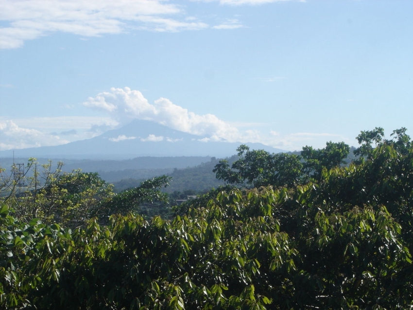
Species List - See the Attachment Below
(Species list may not be complete)
Possible activities
Trekking - difficult, possible to climb up the volcano summit. Several trekking routes.
Rafting, kayaking.
Note
Best time to visit X-XII
One of the least frequented national parks. Very little affected by cilivization because of a difficult access - original type of landscape.
UNESCO World Biosphere Reserve