Basic ecotouristic information on Machalilla National Park (Ecuador) - localization, access, characteristic, fauna and flora, possible activities.
Localization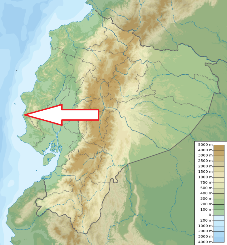
Central part of West Ecuador
Access
Easy along the road from Guayaquil. Take the road to Daule until you reach Nobol (41 km). Here you continue along the Nobol - Jipijapa road, as far as Jipijapa. Then head west towards Puerto Cayo (28 km) taking the Troncal del Pacifico road south until Puerto Lopez (33km).
Characteristic
750 km2 (including marine part); The only coastal National Park in Ecuador - includes strip of the land along the coast, two bigger and several small islands close to the coast. Unlike other areas of the coast, the topography of the coastal strip of Machalilla is very irregular and includes eroded cliffs, rocky beaches where you'll find lots of rocky pools where you might find various marine species. You can also find flat sandy beaches and valleys that meet the Pacific. Interior of the park - slightly rolled landscape covered with thorny bush. Altitudinal range 0-840 m. Typical ecosystems: internationally important wetlands, marine and coastal ecosystems, cloud forest, tropical dry forest, bush desert and sand dunes. Breeding ground for humpback whales close to the park coast. It is estimated 19 percent of the woody plants in the park are endemic.
Fauna + Flora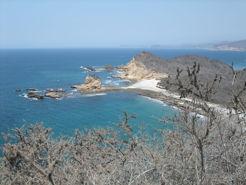
Species List - See the Attachment Below
(Species list may not be complete)
Possible activities
Hiking - several trails; whalewatching
Snorkelling, diving, horseback riding
Note
Several archeological finding places of pre-inca settlements
Park is threatened by various human activities
Best time to visit XII-V