Basic ecotouristic information on Cotopaxi National Park (Ecuador) - localization, access, characteristic, fauna and flora, possible activities.
Localization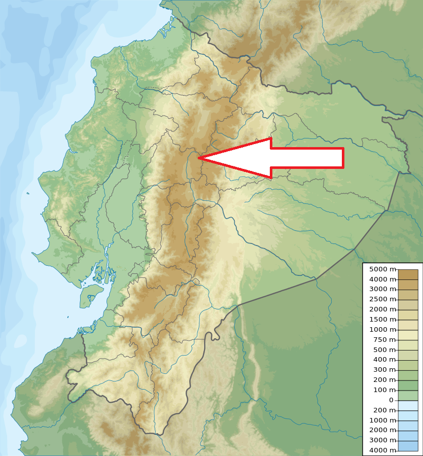
Central Ecuador, 50 km southeast of Quito
Access
Easy - about half and hour drive along Panamericana from Quito to kilometer 42, where the detour to the main entrance to the park is located.
Characteristic
334 km2; High mountainous area dominated with the world highest active volcano and the second highest mountain of Ecuador - Cotopaxi (5,897m) and two more volcanoes (Ruminawi and Sincholagua). Cotopaxi is a spectacular volcano displaying a nearly symmetrical cone shape that rises 3,800 m from its base. A crater with a depth of 250 m sits atop of Cotopaxi. Its dimensions are 800 x 550 m. Park altitude 3,400 - 5,897 m). Limpio Pungo lagoon is located at 3,800 meters above sea level and covers approximately 200 hectares. Typical ecosystems: páramo (mountain steppe), alpine and volcanic biotopes, wetlands (mountain tundra), freshwater ecosystems (rivers and lakes). Only lichens growing in heights above 4500 m.
Fauna + Flora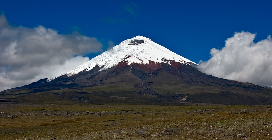
Species List - See the Attachment Below
(Species list may not be complete)
Possible activities
Excellent conditions for walking or more difficult trekking - summit ascending possible only after a few days of acclimatization
mountaineering, mountain bikes, horseback riding
Note
Best time to visit XII-IV
Ruins of pre-incas fortress
Cloud forest in heights from 3400 to 3900 m almost destroyed by human activities.
It is possible to drive a car to the parking palce in the height of 4,600 m.